
History of the Estuary - Part two
By 1900, few iwi remained in Christchurch. Many had moved away from their traditional kainga nohoanga and mahinga kai areas due to increased pollution and development from European settlements. Long-held settlements around Te Ihutai were abandoned in favour of more distant areas such as Tuahiwi (north of the Waimakariri River), Wairewa (Little River), Ōnuku (Akaroa) and Koukourārata (Port Levy). For tangata whenua, the Avon-Heathcote Estuary/Ihutai became- and still remians- a lost resource.
As with Māori settlers before them, early European settlers soon found the estuary and its two rivers to be essential to their livelihood. The estuary was a key trading post with ships bringing not only provisions, livestock, and farming machinery but also social contact to these isolated communities. The rivers flowing into the estuary were their lifeline to the wider world, with their homesteads and small settlements surrounded by wetlands, the steep Port Hills and dense bush.
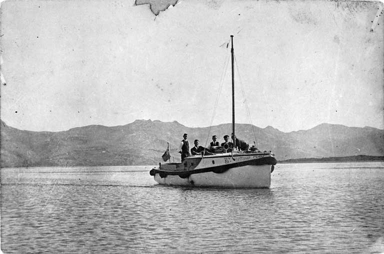
The deeper Heathcote River/Ōpāwho channel was used by trading ships heading through the estuary to St Martins, while schooners used the Avon River/Ōtākaro to take freight and passengers closer into the town of Christchurch. Even in the 1880s residents were still taking a passenger steamer up the Avon River/Ōtākaro to make the journey from New Brighton to Colombo Street.
The completion of both Lyttelton rail tunnel and a network of “metalled” (gravel) roads in the 1860s, coupled with the silting up of the rivers in the 1880s and 1890s, saw the end of river travel and trade in Christchurch.